The next coast along, if you turn east
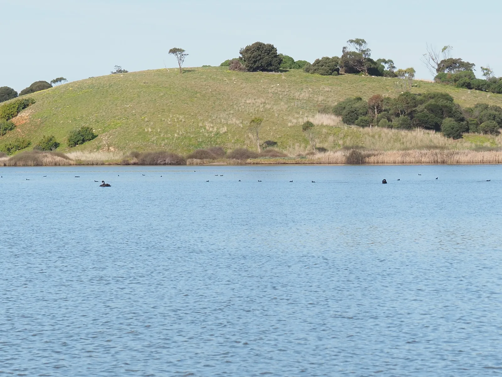
Most days out from Torquay head west down the Great Ocean Road. Breamlea's the other way, and it feels different. About 15 minutes east, the surf town gives way to a long, empty ocean beach, and behind it there's a big shallow lake full of birds, with saltmarsh and mangroves along the lower Barwon. Plenty of people drive straight past on the way to Barwon Heads.
It's an easy half-day, or a morning out when the wind's up on the Torquay beaches. Bancoora Beach is the spot for sand and surf, Taits Point has the wide lake view, and Sheepwash Road in Barwon Heads is the start of a walk beside the river. Do one or two and you'll still be back for a late lunch, or stop in Barwon Heads for it.
Three places to start
Bancoora Beach: Horwood Drive
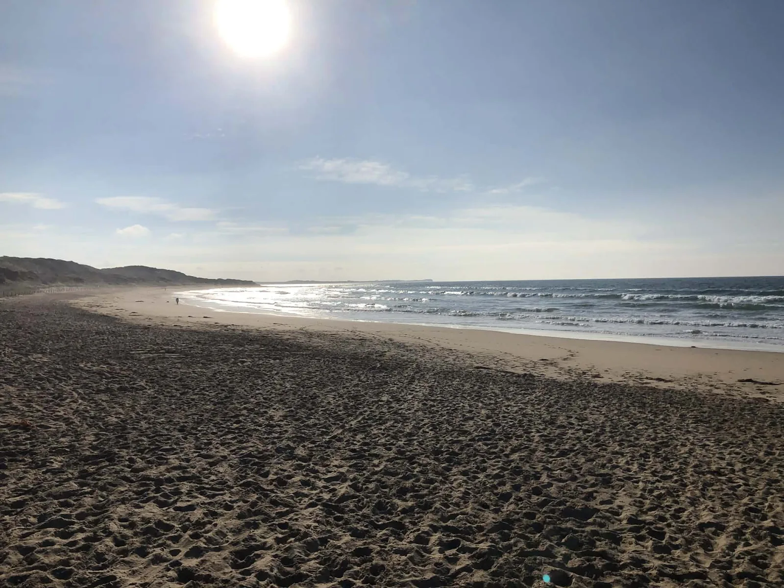
The surf club car park sits behind the dunes at Breamlea. Bancoora's sandy beach is about 1 km long between rocky points. Temporary public toilets are available during the surf club rebuild. Beach access map.
Taits Point: Staceys Road
Turn off Barwon Heads Road at Staceys Road, by the airport, and follow it to the circular car park at the lake. The viewpoint looks across the broad, shallow lagoon. Dogs aren't allowed here. Lake viewpoint map.
Barwon Heads river walk: Sheepwash Road
The river end of Sheepwash Road is the start for this 5.6 km return walk. River Parade has parking, and public toilets are at Village Park on Sheepwash Road. The riverside includes boardwalk and fishing jetties. River walk start map.
Breamlea beach
From north Torquay, take Horseshoe Bend Road to Blackgate Road, then Breamlea Road to Horwood Drive and the surf club car park. It's about 15 minutes and 10 km.
Bancoora faces south-east, with a vegetated dune behind the sand and rocky points at either end. It's named after the steamer Bancoora, which ran aground near Bream Creek in 1891. It's an exposed surf beach with rips, including strong currents beside the rocks, so swim between the red and yellow flags when Bancoora's lifesavers are on patrol.
The surf club is being rebuilt, with completion expected in mid 2027. The beach stays open and the club still patrols, but access around the building changes as the work goes on, and there are temporary toilets for now. Barwon Coast's redevelopment page has the current arrangements.
Kite surfers ride the waves further along, and our kite surfing guide covers that side of it. For everyone else it's a long walk with not many people on it.
Lake Connewarre
Lake Connewarre is one of Victoria's largest estuaries and the largest area of native vegetation on the Bellarine. Parks Victoria looks after it as the Lake Connewarre State Game Reserve.
Bring binoculars. The council says 149 bird species have been recorded here, and the lake regularly holds 10,000 ducks and swans. Look for Caspian terns, yellow-billed spoonbills, straw-necked ibis and cormorants. Along the lower Barwon, migratory shorebirds such as greenshank, curlew sandpipers and red-necked stints feed on the mud in the warmer months. Early morning, when the birds are feeding and the light's soft, is the best time. Taits Point gives you the open-water view; the riverside paths bring you alongside the mangroves.
The council asks visitors to keep about 200 metres from feeding, breeding or roosting birds and to stay on the tracks, because the saltmarsh takes years to recover if it's trampled. The lake isn't for swimming: it's shallow, muddy and the birds' patch.
Duck hunting takes place in designated parts of the reserve during the declared season. Parks Victoria's reserve map shows the areas closed to visitors then. If there's shooting on, come back another morning.
Along the Barwon at Sheepwash Road
The Barwon Heads river walk starts at the flood gauge at the river end of Sheepwash Road. It's a 5.6 km out-and-back walk, about an hour and a half. There's boardwalk beside the river, fishing jetties and seats along the way. The river winds past mangroves and old trees, with people fishing from the bank.
River Parade has parking beside Moonah Park. The woodland paths there pass twisted moonah trees, with seats, a picnic table and views across the river towards Lake Connewarre. Barwon Heads Village Park, back on Sheepwash Road, has public toilets, a playground and barbecues.
Parks Victoria also marks the Barwon River Estuary walk along this part of the river. Dogs are allowed on a lead on that trail. Camping, fires, horses, vehicles and firearms aren't permitted on the walk.
The Barwon Heads guide covers the town, river mouth and bluff further downstream.
Dogs at the beach, lake and river
For an off-lead beach walk at Breamlea, dogs can run between beach markers 47W and 50W all year, as long as they're within sight, come when called and you carry a lead. Car parks and beach access paths are on-lead areas.
Between markers 44W and 47W, the summer rules are different. From 1 December to the end of February, and over Easter weekend, dogs are prohibited from 9am to 7pm and must be on a lead from 7pm to 9am. Outside those periods, dogs can be off lead under effective control. Hooded plover nesting enclosures are dog-free, including within an otherwise off-lead beach zone. The Barwon Coast dog map shows the beach markers and adjoining zones.
At Lake Connewarre, Taits Point is dog-free. The Barwon River Estuary walk allows dogs on a lead, as do the Moonah Park paths.
Breamlea and Lake Connewarre FAQ
How far is Breamlea from north Torquay?
About 15 minutes and 10 km to Bancoora Beach, via Blackgate Road and Breamlea Road. Taits Point is about 25 minutes by car via Lower Duneed Road, Barwon Heads Road and Staceys Road.
Can I take my dog?
For the lake view at Taits Point, no. Dogs are allowed on a lead on the Barwon River Estuary walk and Moonah Park paths. At Breamlea, beach markers 47W to 50W allow dogs off lead under effective control all year.
Is there a walking track around the lake?
There are paths at some lake entrances. Taits Point is the viewpoint at the end of Staceys Road. The separate Barwon Heads river walk starts at Sheepwash Road and is 5.6 km return.
Where are the public toilets?
At Bancoora Beach, temporary public toilets are available during the surf club rebuild. For the riverside walk, Village Park on Sheepwash Road has public toilets.
Is there hunting?
Yes, in parts of the reserve during duck season. Parks Victoria's reserve map, linked above, shows where's closed then.
Can I swim in Lake Connewarre?
No. It's a shallow wetland for the birds. Swim at Bancoora, between the flags when the lifesavers are on patrol.
Is Bancoora patrolled?
In summer, Bancoora Surf Life Saving Club patrols part of the beach; swim between the flags. It's an exposed surf beach with rips. Beachsafe lists patrol availability by day.
Where's the lake viewpoint?
Taits Point, at the end of Staceys Road off Barwon Heads Road near the airport. There's a circular car park at the lake, with views across the open water.
The beaches back towards town are in the Torquay beaches guide. Fishing's covered in fishing in Torquay, and the wind on this beach in the kite surfing guide. The anchors at Torquay and Barwon Heads are on the shipwreck anchors page. When you're ready to stay, check dates and send an enquiry.
Sources
Facts on this page were checked against these sources on 27 October 2026. Opening hours, patrols, rules and closures change — check with the source before you go.
- Shipwrecks — Torquay Museum Without Walls
- Lake Connewarre Game Reserve — City of Greater Geelong
- Bancoora Beach — Surf Life Saving Australia, Beachsafe
- Bancoora SLSC redevelopment — Barwon Coast
- Taits Point Day Visitor Area — Parks Victoria
- Barwon River EstuaryWatch Monitoring Plan — Corangamite Catchment Management Authority and Barwon River EstuaryWatch
- Barwon Heads by foot — Barwon Coast
- Moonah Park — City of Greater Geelong
- Barwon Heads Village Park — City of Greater Geelong
- Barwon River Estuary walk — Parks Victoria
- Dogs on beaches — Barwon Coast
- Dog control zone map — Barwon Coast
- Our wetlands and waterways — City of Greater Geelong
- Lake Connewarre reserve access determination — Parks Victoria